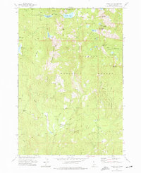
1973 Map of Paddy Flat
USGS Topo · Published 1977About this map
The Paddy Flat high mountain meadows and administrative outposts of the Payette National Forest define this 1970s landscape in Valley County. At the heart of the area, the Paddy Flat Forest Service Station and Paddy Flat Campground serve as central points for forest management and recreation. The terrain is marked by prominent elevations such as Jughandle Mountain and Buckhorn Mtn, with many peaks connected only by primitive pack trails like the Boulder Lake Trail and Buckhorn Trail.
Find a feature on this map
45 named features on this map. Tap any name to fly to it.
Don’t see what you’re looking for? This feature index may not catch every label — zoom into the map to look around manually.
Map Details
Editions of this 1973 Paddy Flat Map
2 editions found
Other maps of this area

1911 · Meadows
USGS Topo · 1:125,000

1954 · Gold Fork
USGS Topo · 1:62,500

1954 · Cascade
USGS Topo · 1:62,500

1955 · Baker
USGS Topo · 1:250,000

1957 · Challis
USGS Topo · 1:250,000

1959 · Baker
USGS Topo · 1:250,000

1960 · Challis
USGS Topo · 1:250,000

1963 · Challis
USGS Topo · 1:250,000

1973 · Blackmare
USGS Topo · 1:24,000

1973 · Fitsum Peak
USGS Topo · 1:24,000