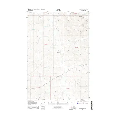
2014 Map of Padlock Ranch
USGS Topo · Published 2014About this map
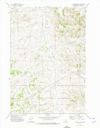
Padlock Ranch serves as the namesake hub of this cattle-ranching landscape in Big Horn County, where the terrain is defined by a dense network of intermittent drainages. The landscape rises toward prominent landmarks like Gracy Butte and the Red Hills, while water resources are meticulously mapped through numerous named draws and creeks. The hydrology of the region is centered on the winding course of Tullock Cr, which is fed by tributaries including Big Meadow Cr, Plum Cr, and the uniquely named Lazy Man Cr. Movement through this area in the early 21st century relied on corridors such as MT-384 and Stullock RD, which connect these remote rangelands. This map provides a detailed view of the township and range system at the intersection of several boundaries, including t1n r35e and t1n r36e, capturing the spatial organization of Montana's eastern ranching country.
Find a feature on this map
22 named features on this map. Tap any name to fly to it.
Don’t see what you’re looking for? This feature index may not catch every label — zoom into the map to look around manually.
Map Details
Editions of this 2014 Padlock Ranch Map
This is the sole edition of this map. No revisions or reprints were ever made.
Other maps of this area

1954 · Hardin
USGS Topo · 1:250,000

1957 · Hardin
USGS Topo · 1:250,000

1958 · Hardin
USGS Topo · 1:250,000

1967 · Jeans Fork NW
USGS Topo · 1:24,000

1967 · Crow Agency NE
USGS Topo · 1:24,000
1967 · Little Dry Creek
USGS Topo · 1:24,000
1972 · The Dugout
USGS Topo · 1:24,000

1972 · Hammond Ranch
USGS Topo · 1:24,000
1972 · Iron Spring
USGS Topo · 1:24,000
1972 · Padlock Ranch
USGS Topo · 1:24,000