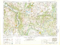
1964 Map of Paducah
USGS Topo · Published 1964About this map
The confluence of the Ohio River and the Mississippi River dominates this mid-century landscape, centering on the strategic river ports of Paducah and Cairo. This intersection of major waterways is further complicated by the arrival of the Tennessee River and the Cumberland River, creating a complex aquatic network that shaped the growth of towns like Metropolis and Brookport. To the north, the industrial character of Southern Illinois is visible in the cluster of mining and rail towns including Marion, Herrin, and West Frankfort. The map illustrates a period when the Crab Orchard National Wildlife Refuge was well established and the Shawnee National Forest protected large swaths of the southern interior. Transport is anchored by the Illinois Central and Missouri Pacific railroads, which linked the river commerce to the growing urban centers in the north and west.
Find a feature on this map
97 named features on this map. Tap any name to fly to it.
Don’t see what you’re looking for? This feature index may not catch every label — zoom into the map to look around manually.
Map Details
Editions of this 1964 Paducah Map
2 editions found
Other maps of this area

1903 · New Harmony
USGS Topo · 1:62,500

1903 · Patoka
USGS Topo · 1:125,000

1905 · Eldorado
USGS Topo · 1:62,500

1905 · New Haven
USGS Topo · 1:62,500

1906 · New Haven
USGS Topo · 1:62,500

1906 · Eldorado
USGS Topo · 1:62,500

1907 · Morganfield
USGS Topo · 1:62,500

1907 · Weingarten
USGS Topo · 1:62,500

1908 · Galatia
USGS Topo · 1:62,500

1908 · Princeton
USGS Topo · 1:62,500