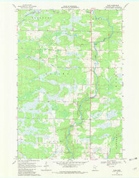
1968 Map of Page
USGS Topo · Published 1982About this map
The Rum River winds southward through this Mille Lacs County landscape, defining the character of the region as it transitions between the civil townships of Bradbury, Onamia, and Dailey. This late 1960s survey documents a terrain dominated by low-lying wetlands and a complex network of tributaries, including Bradbury Brook and the South Fork Bradbury Bk in the north, while Whitney Brook drainage characterizes the south. The small settlement of Page sits near the southern boundary, reflecting the rural and dispersed nature of human occupancy in the area during this era. Evidence of local industry and recreational land use is found in the scattered Gravel Pits and the presence of Wayside Park along the main road corridor. The river's natural course is marked by sections of Rapids, particularly where the channel narrows between the forest and marshland that cover much of the quadrangle.
Find a feature on this map
17 named features on this map. Tap any name to fly to it.
Don’t see what you’re looking for? This feature index may not catch every label — zoom into the map to look around manually.
Map Details
Editions of this 1968 Page Map
2 editions found
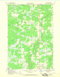
Other maps of this area

1953 · Duluth
USGS Topo · 1:250,000

1953 · Stillwater
USGS Topo · 1:250,000

1955 · Stillwater
USGS Topo · 1:250,000

1958 · Stillwater
USGS Topo · 1:250,000

1958 · Duluth
USGS Topo · 1:250,000

1965 · Stillwater
USGS Topo · 1:250,000

1968 · Ramey NE
USGS Topo · 1:24,000

1968 · Milaca NE
USGS Topo · 1:24,000

1968 · Onamia
USGS Topo · 1:24,000

1968 · Rum River
USGS Topo · 1:24,000