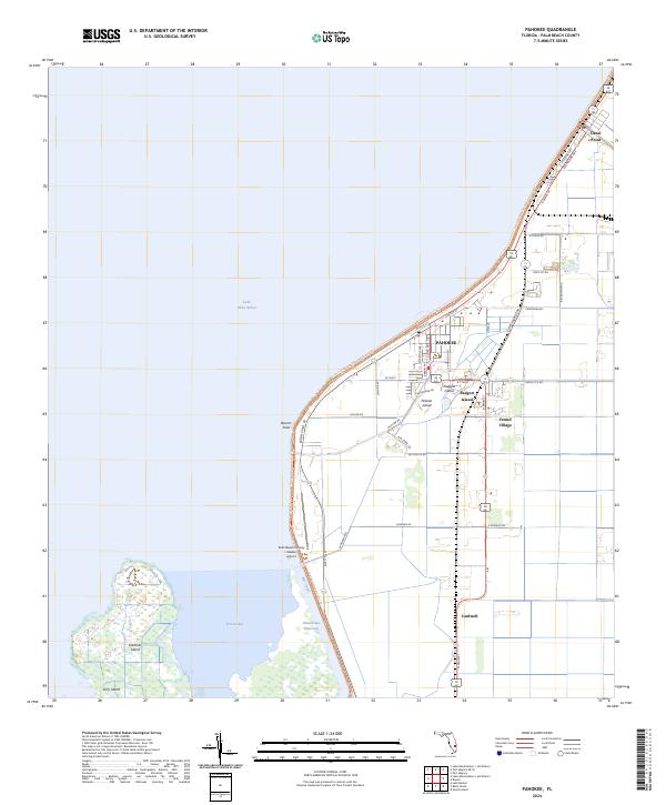
2024 Map of Pahokee
USGS Topo · Published 2024About this map
Pahokee and its surrounding mucklands are detailed here along the southeastern shore of Lake Okeechobee. This agricultural landscape is defined by an intricate network of drainage and transportation, where the Rim Canal and Okeechobee Waterway separate the mainland from islands like Kreamer Island and Torry Island. The town's grid expands toward the lake, bordered by the Florida National Scenic Trl which follows the levee system.
Find a feature on this map
47 named features on this map. Tap any name to fly to it.
Don’t see what you’re looking for? This feature index may not catch every label — zoom into the map to look around manually.
Map Details
Editions of this 2024 Pahokee Map
This is the sole edition of this map. No revisions or reprints were ever made.
Other maps of this area

1956 · West Palm Beach
USGS Topo · 1:250,000

1957 · West Palm Beach
USGS Topo · 1:250,000

1958 · West Palm Beach
USGS Topo · 1:250,000

1970 · Lake Harbor
USGS Topo · 1:24,000

1970 · Belle Glade
USGS Topo · 1:24,000

1970 · Pahokee
USGS Topo · 1:24,000

1970 · Bryant
USGS Topo · 1:24,000

1970 · Sixmile Bend
USGS Topo · 1:24,000
1971 · Port Mayaca
USGS Topo · 1:24,000
1981 · West Palm Beach
USGS Topo · 1:100,000