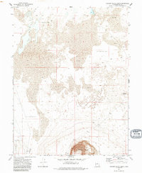
1971 Map of Pahvant Butte North
USGS Topo · Published 1988About this map
Pahvant Butte rises as a dominant geological feature above the low-lying basins of Millard County in the early 1970s. This survey records a desert landscape defined by specialized land management and natural drainage patterns, notably the Mud Depression and the perennial Mud Springs. The southern portion of the sheet is largely occupied by the Clear Lake Waterfowl Management Area, a critical habitat indicated here by its formal boundaries and management labels. Evidence of light industrial use appears at the Cinder Pit near the southern base of the butte, while a primitive transportation network is represented by a single Jeep Trail cutting across the northern mud flats. The terrain is further characterized by small, distinct elevations like Knobby, punctuating an otherwise expansive sink and alkali-flat environment.
Find a feature on this map
13 named features on this map. Tap any name to fly to it.
Don’t see what you’re looking for? This feature index may not catch every label — zoom into the map to look around manually.
Map Details
Editions of this 1971 Pahvant Butte North Map
3 editions found
Other maps of this area

1885 · Sevier Desert
USGS Topo · 1:250,000

1951 · Oak City
USGS Topo · 1:62,500

1953 · Delta
USGS Topo · 1:250,000

1958 · Delta
USGS Topo · 1:250,000

1962 · Delta
USGS Topo · 1:250,000
1962 · The Sink
USGS Topo · 1:24,000

1962 · Holden
USGS Topo · 1:62,500

1962 · Delta
USGS Topo · 1:62,500

1971 · Pavant Butte North
USGS Topo · 1:24,000

1971 · Sunstone Knoll
USGS Topo · 1:24,000