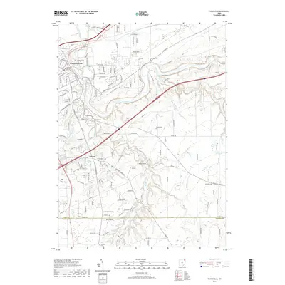
2019 Map of Painesville
USGS Topo · Published 2019About this map
Painesville serves as a focal point along the Grand River in this northern Ohio survey, revealing the established footprint of the county seat. The map documents several significant family and local burial grounds, including the large Evergreen Cem and Riverside Cem, alongside smaller markers of the rural landscape such as Huntoon Cem and Williams Cem. The river's winding course creates dramatic terrain features, most notably the high ground at Indian Point and the location of Cascade Falls. This modern topography highlights how the region's early settlements and landmarks were influenced by the river corridor, from the civic center near the Lake County Courthouse West Annex to the outlying community of Concord. Industrial and recreational sites, such as the Lake Erie Girl Scout Lake, indicate the varied land use across the Lake Co Geauga Co boundary.
Find a feature on this map
168 named features on this map. Tap any name to fly to it.
Don’t see what you’re looking for? This feature index may not catch every label — zoom into the map to look around manually.
Map Details
Editions of this 2019 Painesville Map
This is the sole edition of this map. No revisions or reprints were ever made.
Other maps of this area

1904 · Chardon
USGS Topo · 1:62,500

1905 · Perry
USGS Topo · 1:62,500

1905 · Mentor
USGS Topo · 1:62,500

1906 · Chardon
USGS Topo · 1:62,500

1907 · Mentor
USGS Topo · 1:62,500

1950 · Cleveland
USGS Topo · 1:250,000

1953 · Chardon
USGS Topo · 1:24,000

1953 · Chesterland
USGS Topo · 1:24,000

1953 · Mentor
USGS Topo · 1:24,000

1956 · Cleveland
USGS Topo · 1:250,000