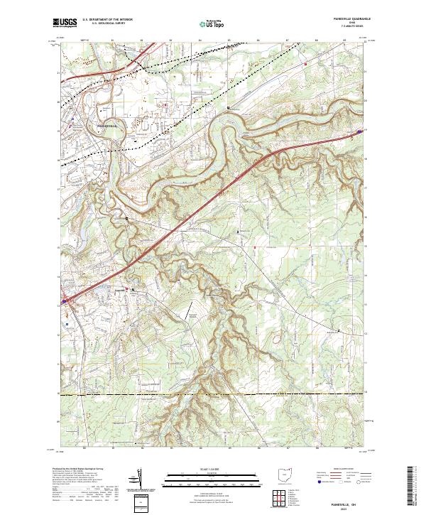
2023 Map of Painesville
USGS Topo · Published 2023About this map
The Grand River carves a deep path through Lake County, defining the geography of Painesville and the neighboring township of Concord. This modern survey reveals a landscape where suburban growth meets preserved natural spaces, characterized by high bluffs like Indian Point and the winding course of Big Creek. The area’s civic and spiritual history is anchored by the Lake County Courthouse West Annex and a dense network of family and community burial grounds, including the Riverside Cem and the Concord Township Cem.
Find a feature on this map
68 named features on this map. Tap any name to fly to it.
Don’t see what you’re looking for? This feature index may not catch every label — zoom into the map to look around manually.
Map Details
Editions of this 2023 Painesville Map
This is the sole edition of this map. No revisions or reprints were ever made.
Historical Maps of Avery Terrace Through Time
3 maps found