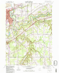
1994 Map of Painesville
USGS Topo · Published 1997About this map
The Grand River carves a deep, winding valley through the center of this Lake County landscape, designated here as the Grand State Scenic River. The city of Painesville dominates the northwestern corner, showing a dense grid of streets and institutional landmarks including St Marys Sch and the Harvey High Sch. Industrial activity is concentrated near the riverbanks, where Sand and Gravel Pits and a Quarry indicate the area's geological utility.
Find a feature on this map
69 named features on this map. Tap any name to fly to it.
Don’t see what you’re looking for? This feature index may not catch every label — zoom into the map to look around manually.
Map Details
Editions of this 1994 Painesville Map
This is the sole edition of this map. No revisions or reprints were ever made.
Other maps of this area

1904 · Chardon
USGS Topo · 1:62,500

1905 · Perry
USGS Topo · 1:62,500

1905 · Mentor
USGS Topo · 1:62,500

1906 · Chardon
USGS Topo · 1:62,500

1907 · Mentor
USGS Topo · 1:62,500

1950 · Cleveland
USGS Topo · 1:250,000

1953 · Chardon
USGS Topo · 1:24,000

1953 · Chesterland
USGS Topo · 1:24,000

1953 · Mentor
USGS Topo · 1:24,000

1956 · Cleveland
USGS Topo · 1:250,000