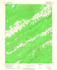
1966 Map of Paint Bank
USGS Topo · Published 1968About this map
The mountain-and-valley landscape of the West Virginia and Virginia border comes into sharp focus in this mid-1960s survey. The community of Paint Bank sits at the junction of the Potts Creek valley, where an Old RR Grade follows the water's edge, signaling the area's older industrial transport patterns. To the northwest, the settlements of Centennial and Roxalia are framed by the massive ridges of Peters Mountain and Sweet Springs Mountain. This survey details the rural infrastructure of the era, recording local congregations at Pine Grove Ch and Cokesbury Ch, alongside family burial grounds like Bostic Cem. The inclusion of Moncove Lake and its Boat Ramp contrasts with the working-land features of the Jefferson National Forest, where a single Mine label and various timber-lined ridges define the high country.
Find a feature on this map
34 named features on this map. Tap any name to fly to it.
Don’t see what you’re looking for? This feature index may not catch every label — zoom into the map to look around manually.
Map Details
Editions of this 1966 Paint Bank Map
2 editions found
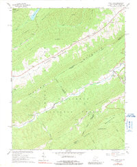
Other maps of this area

1887 · Lewisburg
USGS Topo · 1:125,000

1890 · Christiansburg
USGS Topo · 1:125,000

1891 · Lewisburg
USGS Topo · 1:125,000

1921 · Ronceverte
USGS Topo · 1:48,000

1923 · Ronceverte
USGS Topo · 1:62,500

1923 · Waiteville
USGS Topo · 1:62,500

1929 · Salem
USGS Topo · 1:48,000

1931 · Waiteville
USGS Topo · 1:48,000

1932 · Salem
USGS Topo · 1:62,500

1944 · Waiteville
USGS Topo · 1:62,500