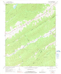
1966 Map of Paint Bank
USGS Topo · Published 1991About this map
The settlement of Paint Bank sits at the junction of several valley routes in the mid-1960s, marking a significant point along the Potts Creek corridor where West Virginia and Virginia meet. The landscape is defined by the massive presence of Peters Mountain and Gap Mountain, which divide the region into isolated valleys where farming and timber operations established small communities like Roxalia and Centennial. This survey identifies several religious and memorial sites central to local genealogy, including Pine Grove Ch, Cokesbury Ch, and the Mountain View Cem. Cultural history is visible in the physical geography, where an Old RR Grade follows the creek near the state line, indicating former industrial connections that supported local mining and timber extraction within the Jefferson National Forest.
Find a feature on this map
32 named features on this map. Tap any name to fly to it.
Don’t see what you’re looking for? This feature index may not catch every label — zoom into the map to look around manually.
Map Details
Editions of this 1966 Paint Bank Map
2 editions found
Other maps of this area

1887 · Lewisburg
USGS Topo · 1:125,000

1890 · Christiansburg
USGS Topo · 1:125,000

1891 · Lewisburg
USGS Topo · 1:125,000

1921 · Ronceverte
USGS Topo · 1:48,000

1923 · Ronceverte
USGS Topo · 1:62,500

1923 · Waiteville
USGS Topo · 1:62,500

1929 · Salem
USGS Topo · 1:48,000

1931 · Waiteville
USGS Topo · 1:48,000

1932 · Salem
USGS Topo · 1:62,500

1944 · Waiteville
USGS Topo · 1:62,500