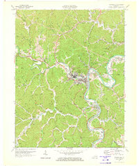
1971 Map of Paintsville
USGS Topo · Published 1973About this map
Paintsville serves as the focal point of this Eastern Kentucky landscape, situated at the confluence of Paint Creek and the Levisa Fork. The town's industrial and civic footprint is well-defined, showing the Chesapeake and Ohio railroad corridor, the Paintsville Golf Course, and significant infrastructure like the Filtration Plant and Sewage Disposal. Outside the central hub, the terrain is characterized by steep ridges and narrow hollows dotted with zahlreiche coal mines and gas wells, illustrating the region's reliance on resource extraction.
Find a feature on this map
56 named features on this map. Tap any name to fly to it.
Don’t see what you’re looking for? This feature index may not catch every label — zoom into the map to look around manually.
Map Details
Editions of this 1971 Paintsville Map
2 editions found
Other maps of this area

1886 · Prestonsburg
USGS Topo · 1:125,000

1892 · Prestonsburg
USGS Topo · 1:125,000

1914 · Laynesville
USGS Topo · 1:48,000

1914 · Inez
USGS Topo · 1:48,000

1915 · Paintsville
USGS Topo · 1:48,000

1915 · Prestonsburg
USGS Topo · 1:62,500

1916 · Harold
USGS Topo · 1:62,500

1916 · Inez
USGS Topo · 1:62,500

1917 · Paintsville
USGS Topo · 1:62,500

1918 · Prestonsburg
USGS Topo · 1:62,500