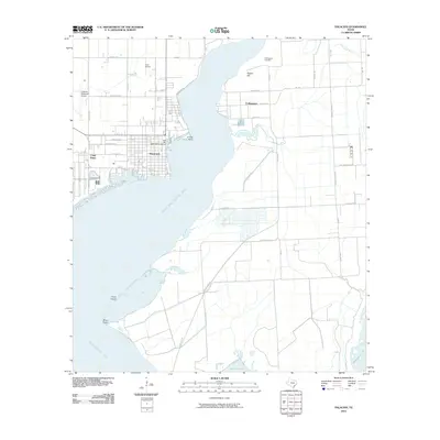
2010 Map of Palacios
USGS Topo · Published 2010About this map
Palacios anchors the western shore of Tres Palacios Bay in this coastal survey, where the town's grid meets the harbor at the East Bay Yacht Harbor Marina. To the south, the landscape transitions into the tidal marshes and open waters of Matagorda Bay, defined by landmarks such as Coon Island and Oliver Point. The area's history is evident in the presence of Camp Hulen, once a significant military installation situated along the shoreline.
Find a feature on this map
39 named features on this map. Tap any name to fly to it.
Don’t see what you’re looking for? This feature index may not catch every label — zoom into the map to look around manually.
Map Details
Editions of this 2010 Palacios Map
This is the sole edition of this map. No revisions or reprints were ever made.
Other maps of this area

1952 · Palacios SE
USGS Topo · 1:24,000

1952 · Palacios Point
USGS Topo · 1:24,000

1952 · Blessing SE
USGS Topo · 1:24,000

1952 · Palacios
USGS Topo · 1:24,000

1952 · Turtle Bay
USGS Topo · 1:24,000

1952 · Francitas
USGS Topo · 1:24,000

1952 · Blessing
USGS Topo · 1:24,000

1952 · Palacios NE
USGS Topo · 1:24,000

1953 · Beeville
USGS Topo · 1:250,000

1956 · Beeville
USGS Topo · 1:250,000