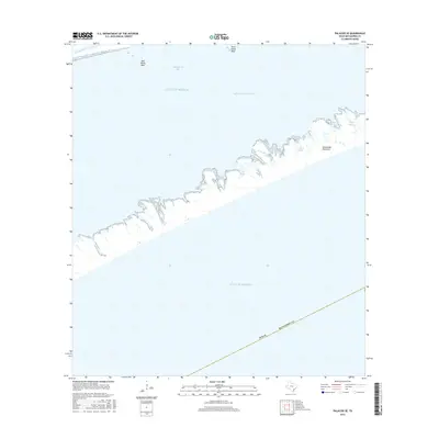
2016 Map of Palacios SE
USGS Topo · Published 2016About this map
Matagorda Peninsula forms a narrow protective barrier between the open Gulf of Mexico and the ecologically diverse Matagorda Bay system along the Texas coast. This survey illustrates a dynamic coastal landscape where the Intracoastal Waterway cuts through the northern reach, facilitating maritime transit behind the shelter of the peninsula. The landform itself is punctuated by numerous tidal inlets and water bodies, including Maverick Bayou, Big Bayou, and Forked Bayou. These features, along with oyster habitats like Mad Island Reef and Shell Island Reef, characterize a region shaped by shifting sands and the steady influence of the tide. The map provides a clear look at the intricate shoreline of the peninsula, including the secluded waters of Hooper Bayou and Long Bayou on the bay side.
Find a feature on this map
12 named features on this map. Tap any name to fly to it.
Don’t see what you’re looking for? This feature index may not catch every label — zoom into the map to look around manually.
Map Details
Editions of this 2016 Palacios SE Map
This is the sole edition of this map. No revisions or reprints were ever made.
Other maps of this area

1951 · Bay City
USGS Topo · 1:250,000

1952 · Palacios SE
USGS Topo · 1:24,000

1952 · Palacios Point
USGS Topo · 1:24,000

1952 · Matagorda
USGS Topo · 1:24,000

1952 · Palacios
USGS Topo · 1:24,000
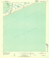
1952 · Matagorda SW
USGS Topo · 1:24,000

1952 · South of Palacios Point
USGS Topo · 1:24,000

1952 · Palacios NE
USGS Topo · 1:24,000

1953 · Beeville
USGS Topo · 1:250,000

1956 · Beeville
USGS Topo · 1:250,000