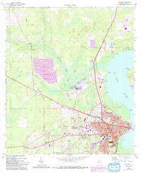
1968 Map of Palatka
USGS Topo · Published 1992About this map
The St Johns River defines the eastern edge of this Putnam County landscape, where the bustling city of Palatka sits alongside the sprawling Rice Creek Swamp. The late 1960s survey, updated with late 1980s aerial photography, captures the city’s established institutional core, including the Courthouse, St Johns River Jr College, and Putnam Memorial Hospital. South of the city center, the manicured terrain of Ravine Gardens State Park provides a sharp contrast to the industrial footprints of the Industrial Waste Ponds and the nearby Filtration Plant along Rice Creek. To the west, the map documents smaller communities such as Francis and Bardin, alongside rural landmarks like the Etonia Ch Cem and Midway Ch. This period shows the integration of older infrastructure, like the Georgia Southern and Florida railroad line, with modern transportation hubs like the Kay Larkin Airport.
Find a feature on this map
47 named features on this map. Tap any name to fly to it.
Don’t see what you’re looking for? This feature index may not catch every label — zoom into the map to look around manually.
Map Details
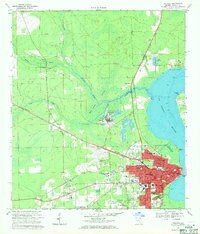
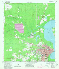
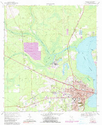
Editions of this 1968 Palatka Map
4 editions found
Other maps of this area

1912 · Palatka
USGS Topo · 1:48,000

1915 · Palatka
USGS Topo · 1:62,500

1915 · Interlachen
USGS Topo · 1:48,000

1916 · Interlachen
USGS Topo · 1:62,500

1942 · Ates Creek
USGS Topo · 1:62,500

1944 · Interlachen
USGS Topo · 1:62,500

1947 · Bostwick
USGS Topo · 1:50,000

1949 · Rice Creek
USGS Topo · 1:24,000

1949 · Bostwick
USGS Topo · 1:24,000

1949 · Baywood
USGS Topo · 1:24,000