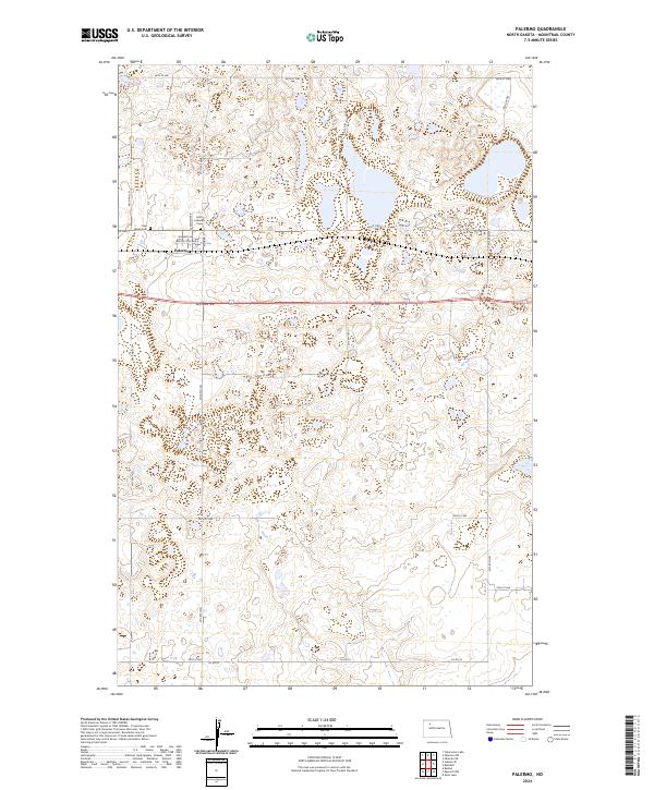
2024 Map of Palermo
USGS Topo · Published 2024About this map
Palermo serves as the focal point of this northern plains survey, where a grid of rural section roads meets the historic alignment of Old Hwy 2. The settlement is characterized by a concentrated street network including Broadway St and Washington Ave, reflecting a traditional small-town layout surrounded by extensive prairie wetlands. The conservation landscape is notably shaped by the Mountrail County Waterfowl Production Area, which preserves numerous scattered glacial potholes and basins across the township lines. Local history is anchored by the presence of Rest Haven Cem and Faith Lutheran Cem on the western edge of town. The transition from early transport routes to modern infrastructure is visible in the relationship between Norway Ave and the newer highway corridors that bypass the central district.
Find a feature on this map
26 named features on this map. Tap any name to fly to it.
Don’t see what you’re looking for? This feature index may not catch every label — zoom into the map to look around manually.
Map Details
Editions of this 2024 Palermo Map
This is the sole edition of this map. No revisions or reprints were ever made.
Other maps of this area

1953 · Williston
USGS Topo · 1:250,000

1957 · Williston
USGS Topo · 1:250,000

1969 · Stanley SE
USGS Topo · 1:24,000

1981 · Stanley SE
USGS Topo · 1:24,000
1981 · Palermo NE
USGS Topo · 1:24,000

1981 · Palermo
USGS Topo · 1:24,000
1981 · Shell Lake
USGS Topo · 1:24,000
1981 · Palermo NW
USGS Topo · 1:24,000
1981 · Epworth NW
USGS Topo · 1:24,000
1981 · Blaisdell
USGS Topo · 1:24,000