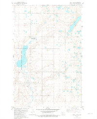
1981 Map of Shell Lake
USGS Topo · Published 1981About this map
Shell Lake National Wildlife Refuge dominates the western portion of this Mountrail County landscape, preserving the prairie wetlands surrounding Shell Lake. This 1981 survey illustrates a sparse rural environment organized by civil townships, including McAlmond, Kickapoo, and Osloe. Local life is anchored by small landmarks such as the Shell Lake Ch and Trinity Cem in the southeastern corner. The terrain is a complex pattern of numerous small potholes and depressions characteristic of the Missouri Coteau. Evidence of local industry is limited to several Gravel Pits scattered across the township lines, while Shell Creek provides a natural drainage route through the undulating plains. The map reflects a period of established conservation and traditional land use in North Dakota's prairie pothole region.
Find a feature on this map
9 named features on this map. Tap any name to fly to it.
Don’t see what you’re looking for? This feature index may not catch every label — zoom into the map to look around manually.
Map Details
Editions of this 1981 Shell Lake Map
This is the sole edition of this map. No revisions or reprints were ever made.
Other maps of this area

1953 · Williston
USGS Topo · 1:250,000

1954 · Minot
USGS Topo · 1:250,000

1957 · Williston
USGS Topo · 1:250,000

1958 · Minot
USGS Topo · 1:250,000

1980 · Minot
USGS Topo · 1:100,000
1980 · Plaza
USGS Topo · 1:24,000

1980 · Tagus
USGS Topo · 1:24,000
1981 · Epworth SE
USGS Topo · 1:24,000

1981 · Palermo
USGS Topo · 1:24,000
1981 · Epworth
USGS Topo · 1:24,000