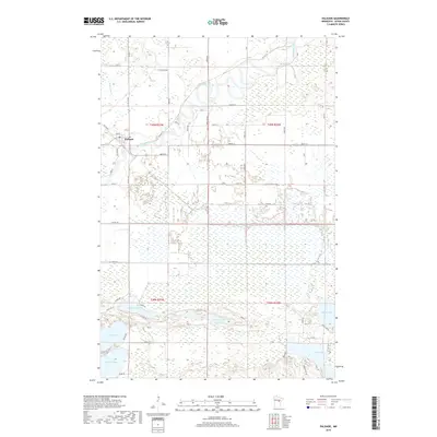
2019 Map of Palisade
USGS Topo · Published 2019About this map
The Mississippi River winds through this northern landscape, defining the character of the river valley as it approaches the settlement of Palisade. This 2019 survey shows the town at a local intersection where the Willow River joins the larger waterway. The northern half of the map is dominated by the sprawling wetlands and low-lying floodplains characteristic of the upper Mississippi basin, punctuated by a grid of rural routes such as Co Hwy 10 and St Wildlife Rd.
Find a feature on this map
55 named features on this map. Tap any name to fly to it.
Don’t see what you’re looking for? This feature index may not catch every label — zoom into the map to look around manually.
Map Details
Editions of this 2019 Palisade Map
This is the sole edition of this map. No revisions or reprints were ever made.
Other maps of this area

1914 · Aitkin
USGS Topo · 1:62,500

1915 · Aitkin
USGS Topo · 1:62,500

1953 · Duluth
USGS Topo · 1:250,000

1958 · Duluth
USGS Topo · 1:250,000

1970 · Kimberly
USGS Topo · 1:24,000

1970 · Mc Gregor
USGS Topo · 1:24,000

1970 · Palisade
USGS Topo · 1:24,000

1970 · Sanders Lake
USGS Topo · 1:24,000

1970 · Libby
USGS Topo · 1:24,000
1970 · Minnewawa
USGS Topo · 1:24,000