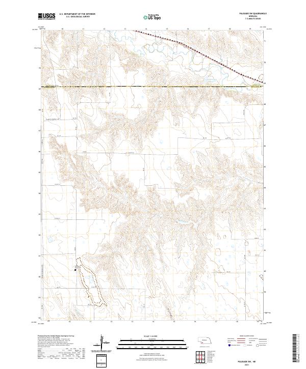
2021 Map of Palisade SW
USGS Topo · Published 2021About this map
The Pleasant Ridge Cem sits on a plateau overlooking the drainage of Bobtail Cr and Camp Cr in this portion of southwestern Nebraska. The terrain is defined by deeply incised draws and canyons, most notably Dry Canyon, which cut through the high plains landscape between the Hayes County and Hitchcock County border. The map illustrates a strictly rural section of the state, where the section-line road network, including Hayes Co Co Line Rd and Veterans Memorial Hwy, provides the primary structure for the agricultural landscape. The presence of the Kroster-Rice Reservoir in the northern reaches indicates the critical importance of water management in this arid region, where intermittent creeks and natural reservoirs are vital for livestock and local irrigation.
Find a feature on this map
71 named features on this map. Tap any name to fly to it.
Don’t see what you’re looking for? This feature index may not catch every label — zoom into the map to look around manually.
Map Details
Editions of this 2021 Palisade SW Map
This is the sole edition of this map. No revisions or reprints were ever made.
Other maps of this area

1954 · McCook
USGS Topo · 1:250,000

1957 · McCook
USGS Topo · 1:250,000

1958 · McCook
USGS Topo · 1:250,000

1962 · Trenton
USGS Topo · 1:24,000

1962 · Stratton
USGS Topo · 1:24,000

1962 · Max NE
USGS Topo · 1:24,000

1973 · Palisade
USGS Topo · 1:24,000

1973 · Palisade SW
USGS Topo · 1:24,000

1973 · Wauneta SE
USGS Topo · 1:24,000

1974 · Hamlet
USGS Topo · 1:24,000