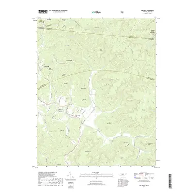
2019 Map of Pall Mall
USGS Topo · Published 2019About this map
Pall Mall and the surrounding borderlands of Tennessee and Kentucky are defined by the deep valleys and ridges of the Cumberland Plateau. The Wolf River winds through the central portion of the landscape, serving as a primary corridor for settlement and transit. This map captures the region's enduring rural character, where small communities like Travisville and Forbus are situated among prominent heights such as Frogg Mtn and Arion Mtn.
Find a feature on this map
92 named features on this map. Tap any name to fly to it.
Don’t see what you’re looking for? This feature index may not catch every label — zoom into the map to look around manually.
Map Details
Editions of this 2019 Pall Mall Map
This is the sole edition of this map. No revisions or reprints were ever made.
Other maps of this area

1895 · Wartburg
USGS Topo · 1:125,000

1896 · Wartburg
USGS Topo · 1:125,000

1897 · Standingstone
USGS Topo · 1:125,000

1898 · Standingstone
USGS Topo · 1:125,000

1929 · Byrdstown
USGS Topo · 1:62,500

1934 · Pall Mall
USGS Topo · 1:62,500

1954 · Stockton
USGS Topo · 1:24,000

1954 · Parmleysville
USGS Topo · 1:24,000

1954 · Jamestown
USGS Topo · 1:24,000

1954 · Savage
USGS Topo · 1:24,000