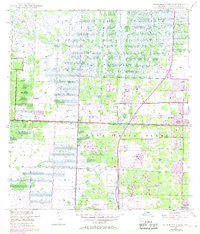
1946 Map of Palm Beach Farms
USGS Topo · Published 1968About this map
The Loxahatchee Slough dominates the northern reaches of this landscape, a complex network of wetlands that meets the encroaching development of South Florida's mid-century expansion. This document captures a transformative period where traditional land use, represented by the namesake Palm Beach Farms, began to yield to suburban growth and infrastructure. The introduction of the Sunshine State Parkway, complete with Interchange 9 and a tollgate, signals the rising importance of high-speed transit.
Find a feature on this map
22 named features on this map. Tap any name to fly to it.
Don’t see what you’re looking for? This feature index may not catch every label — zoom into the map to look around manually.
Map Details
Editions of this 1946 Palm Beach Farms Map
3 editions found
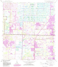
Other maps of this area

1945 · Delta
USGS Topo · 1:24,000

1945 · Greenacres City
USGS Topo · 1:24,000

1945 · Lake Worth
USGS Topo · 1:24,000

1946 · Riviera Beach
USGS Topo · 1:24,000

1946 · Palm Beach Farms
USGS Topo · 1:24,000

1946 · Palm Beach
USGS Topo · 1:24,000

1949 · Lake Worth
USGS Topo · 1:24,000

1949 · Palm Beach Farms
USGS Topo · 1:24,000

1949 · Riviera Beach
USGS Topo · 1:24,000

1950 · Greenacres City
USGS Topo · 1:24,000