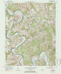
1952 Map of Palmer
USGS Topo · Published 1984About this map
The Kentucky River and its major tributary, the Red River, dictate the rugged geography of this Estill and Madison County borderland. In the early 1950s, the winding waterway is defined by dramatic meanders such as Maupin Bend, Thornburg Bend, and the Lower Bend. Navigation on the river is marked by the presence of Lock No 11, while the high ridge known as the Devils Backbone rises sharply between the converging currents.
Find a feature on this map
77 named features on this map. Tap any name to fly to it.
Don’t see what you’re looking for? This feature index may not catch every label — zoom into the map to look around manually.
Map Details
Editions of this 1952 Palmer Map
Other maps of this area

1892 · Richmond
USGS Topo · 1:125,000

1892 · Beattyville
USGS Topo · 1:125,000

1897 · Richmond
USGS Topo · 1:125,000

1950 · Levee
USGS Topo · 1:24,000

1952 · Union City
USGS Topo · 1:24,000

1952 · Palmer
USGS Topo · 1:24,000

1952 · Clay City
USGS Topo · 1:24,000

1952 · Levee
USGS Topo · 1:24,000

1952 · Winchester
USGS Topo · 1:24,000

1952 · Irvine
USGS Topo · 1:24,000