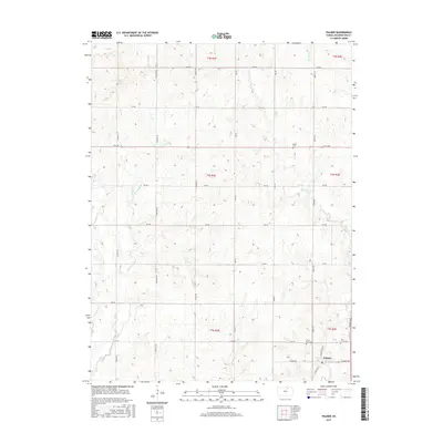
2015 Map of Palmer
USGS Topo · Published 2015About this map
Palmer serves as the primary hub in this portion of Washington County, situated along the southeastern edge of the map. The landscape is defined by a systematic grid of section roads, including Heritage Rd and Liberty Rd, which navigate a terrain carved by numerous north-south drainages. Waterways such as Peats Cr and Spring Cr snake through the farmland, shaping the agricultural layout of the region. Family and community heritage is anchored by several burial sites scattered across the township, including Saint Louis Cem and Saint Paul Cem near the town center, and the more isolated Reiter Cem to the north. The area's reliance on its drainage network is evident in the labeling of diverse branches, such as E Br Parsons Cr, which feed the larger creek systems that characterize this part of north-central Kansas.
Find a feature on this map
34 named features on this map. Tap any name to fly to it.
Don’t see what you’re looking for? This feature index may not catch every label — zoom into the map to look around manually.
Map Details
Editions of this 2015 Palmer Map
This is the sole edition of this map. No revisions or reprints were ever made.
Other maps of this area

1893 · Washington
USGS Topo · 1:125,000

1955 · Manhattan
USGS Topo · 1:250,000

1956 · Manhattan
USGS Topo · 1:250,000

1957 · Manhattan
USGS Topo · 1:250,000

1965 · Clifton
USGS Topo · 1:24,000

1965 · Brantford
USGS Topo · 1:24,000

1966 · Morrowville
USGS Topo · 1:24,000

1966 · Washington
USGS Topo · 1:24,000
1966 · Haddam
USGS Topo · 1:24,000
1968 · Linn SW
USGS Topo · 1:24,000