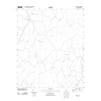
2011 Map of Palmetto
USGS Topo · Published 2011About this map
Lubbub Creek and its many tributaries, including Wild Goose Creek and Beaver Creek, define the landscape of this rural Pickens County area. The community of Palmetto sits at the junction of Palmetto Rd and Co Rd 59, while the smaller settlements of Zion and Fairview anchor the southeastern reaches. This terrain is notably dotted with family and community burial grounds, providing a significant record for genealogical research in western Alabama. Landmarks like Mount Tabor Cemetery near the northern border and Hannah Cemetery to the south reflect the deep-rooted local history of the region. Water management for local use is evident at Orrs Lake, controlled by the Orrs Lake Dam along one of the numerous branches feeding the larger creek systems. The network of county roads, such as Roland Kirk Rd and Johnny Boyd Wilkins Rd, connects these dispersed homesteads and agricultural tracts.
Find a feature on this map
64 named features on this map. Tap any name to fly to it.
Don’t see what you’re looking for? This feature index may not catch every label — zoom into the map to look around manually.
Map Details
Editions of this 2011 Palmetto Map
This is the sole edition of this map. No revisions or reprints were ever made.
Other maps of this area

1953 · Birmingham
USGS Topo · 1:250,000

1953 · West Point
USGS Topo · 1:250,000

1956 · Birmingham
USGS Topo · 1:250,000

1957 · Birmingham
USGS Topo · 1:250,000

1958 · West Point
USGS Topo · 1:250,000

1963 · West Point
USGS Topo · 1:250,000

1967 · Carrollton
USGS Topo · 1:24,000

1967 · Brownville
USGS Topo · 1:24,000

1967 · Newtonville
USGS Topo · 1:24,000

1967 · Kennedy
USGS Topo · 1:24,000