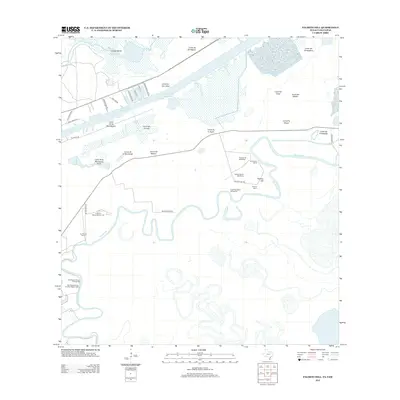
2012 Map of Palmito Hill
USGS Topo · Published 2012About this map
The Palmito Hill Battlefield and Palmito Ranch Battlefield dominate the cultural landscape of this coastal quadrangle, marking the site of the final land engagement of the American Civil War. Situated along the meandering course of the Rio Grande, these grounds are interspersed with historical ranching sites such as Old Palmito Ranch and Palmito Ranch. The topography is defined by a series of lomas—natural clay dunes—including Palmito Hill, Loma de la Montuosa, and Loma del Muerto, which provided strategic elevation in the otherwise low-lying delta. To the north, the industrial influence of the Brownsville Ship Channel and the Goose Island Passing Basin contrasts with the traditional river-based boundary markers known as bancos, including El Rincon Banco Number 126 and San Miguel Banco Number 88. This terrain illustrates the enduring intersection of military history, maritime commerce, and the shifting geography of the international border.
Find a feature on this map
41 named features on this map. Tap any name to fly to it.
Don’t see what you’re looking for? This feature index may not catch every label — zoom into the map to look around manually.
Map Details
Editions of this 2012 Palmito Hill Map
This is the sole edition of this map. No revisions or reprints were ever made.
Other maps of this area

1929 · Palmito Hill
USGS Topo · 1:24,000

1929 · Point Isabel
USGS Topo · 1:24,000

1929 · Laguna Vista
USGS Topo · 1:24,000

1930 · Los Fresnos
USGS Topo · 1:24,000

1930 · East Brownsville
USGS Topo · 1:24,000

1934 · Port Isabel
USGS Topo · 1:31,680

1936 · Los Fresnos
USGS Topo · 1:31,680

1936 · Palmito Hill
USGS Topo · 1:31,680

1936 · Laguna Vista
USGS Topo · 1:31,680
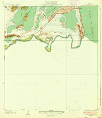
1936 · Mouth Of Rio Grande
USGS Topo · 1:31,680