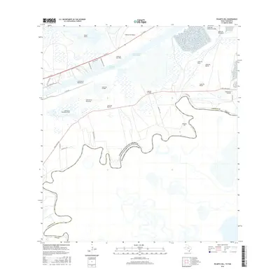
2016 Map of Palmito Hill
USGS Topo · Published 2016About this map
Palmito Hill overlooks the winding course of the Rio Grande along the international border between the United States of America and Mexico. This coastal landscape in Cameron County is defined by its series of low-lying ridges or lomas, including Loma del Muerto, Loma de la Jauja, and Loma Tia Tules, which rise above the surrounding wetlands. To the north, the industrial character of the region is evident where the Brownsville Ship Channel and the Intracoastal Waterway cut through the terrain near Goose Island. Local access is provided by a network of ranch and coastal roads such as Gavito Ranch Rd and Boca Chica Blvd, which navigate the complex topography of the delta. The proximity of the river to these named high points reflects the area's strategic importance and its deep-rooted ranching heritage.
Find a feature on this map
35 named features on this map. Tap any name to fly to it.
Don’t see what you’re looking for? This feature index may not catch every label — zoom into the map to look around manually.
Map Details
Editions of this 2016 Palmito Hill Map
This is the sole edition of this map. No revisions or reprints were ever made.
Other maps of this area

1929 · Palmito Hill
USGS Topo · 1:24,000

1929 · Point Isabel
USGS Topo · 1:24,000

1929 · Laguna Vista
USGS Topo · 1:24,000

1930 · Los Fresnos
USGS Topo · 1:24,000

1930 · East Brownsville
USGS Topo · 1:24,000

1934 · Port Isabel
USGS Topo · 1:31,680

1936 · Los Fresnos
USGS Topo · 1:31,680

1936 · Palmito Hill
USGS Topo · 1:31,680

1936 · Laguna Vista
USGS Topo · 1:31,680
1936 · Mouth Of Rio Grande
USGS Topo · 1:31,680