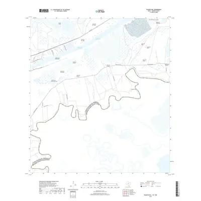
2019 Map of Palmito Hill
USGS Topo · Published 2019About this map
Palmito Hill rises above the marshy coastal plains near the mouth of the Rio Grande, marking a landscape defined by its proximity to the international border with Mexico. The terrain is characterized by numerous lomas, or small elevations, such as Loma del Muerto and Loma de la Montuosa, which provide relief from the surrounding wetlands. This coastal corridor is dominated by heavy maritime infrastructure, including the Brownsville Ship Channel and the Intracoastal Waterway, facilitating trade and transit north of the river. Local roads like Gavito Ranch Rd and Boca Chica Blvd thread through the lomas, connecting these distinct topographical features to the maritime channels and the historic river bends that have shifted over time.
Find a feature on this map
33 named features on this map. Tap any name to fly to it.
Don’t see what you’re looking for? This feature index may not catch every label — zoom into the map to look around manually.
Map Details
Editions of this 2019 Palmito Hill Map
This is the sole edition of this map. No revisions or reprints were ever made.
Other maps of this area

1929 · Palmito Hill
USGS Topo · 1:24,000

1929 · Point Isabel
USGS Topo · 1:24,000

1929 · Laguna Vista
USGS Topo · 1:24,000

1930 · Los Fresnos
USGS Topo · 1:24,000

1930 · East Brownsville
USGS Topo · 1:24,000

1934 · Port Isabel
USGS Topo · 1:31,680

1936 · Los Fresnos
USGS Topo · 1:31,680

1936 · Palmito Hill
USGS Topo · 1:31,680

1936 · Laguna Vista
USGS Topo · 1:31,680
1936 · Mouth Of Rio Grande
USGS Topo · 1:31,680