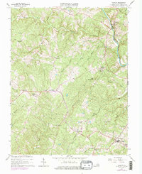
1967 Map of Palmyra
USGS Topo · Published 1975About this map
Rivanna River currents and the Chesapeake and Ohio railroad corridor shape this mid-century portrait of Fluvanna County. The map details a landscape transitioning from rural crossroads to more established community hubs, anchored by the Fork Union Military Academy in the south and the county seat at Palmyra in the northeast. This 1967 survey, updated with 1974 photogrammetric data, reveals the distribution of community anchors like Abrams High Sch and Central Sch, alongside numerous country churches including Burning Bush Ch and Independent Holiness Ch. Topographical landmarks such as Little Mountain Hill and Mountain Hill rise between the creek valleys of Cunningham Creek and Raccoon Creek, illustrating the drainage patterns that historically dictated settlement at Central Plains and Kidds Store.
Find a feature on this map
41 named features on this map. Tap any name to fly to it.
Don’t see what you’re looking for? This feature index may not catch every label — zoom into the map to look around manually.
Map Details
Editions of this 1967 Palmyra Map
Other maps of this area

1891 · Palmyra
USGS Topo · 1:125,000

1895 · Palmyra
USGS Topo · 1:125,000

1897 · Palmyra
USGS Topo · 1:125,000

1943 · Scottsville
USGS Topo · 1:62,500

1946 · Scottsville
USGS Topo · 1:62,500

1947 · Roanoke
USGS Topo · 1:250,000

1950 · Dillwyn
USGS Topo · 1:62,500

1958 · Dillwyn
USGS Topo · 1:62,500

1959 · Roanoke
USGS Topo · 1:250,000

1960 · Columbia
USGS Topo · 1:62,500