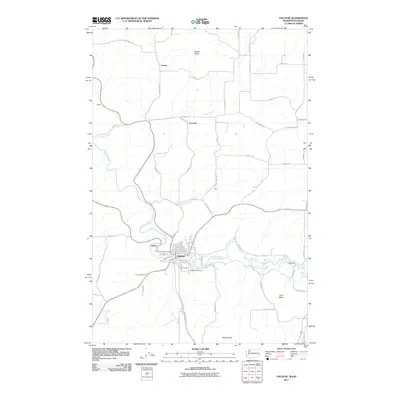
2011 Map of Palouse
USGS Topo · Published 2011About this map
The Palouse River winds through this 2011 survey, defining the heart of Palouse where a grid of streets like N Bridge St and E Mohr St reflects the town’s long-standing role as a local hub. The map illustrates a rural landscape marked by scattered settlements and high-elevation points such as Ladow Butte to the north and Ringo Butte near the southern border. Smaller localities like Lairds, Grinnell, and Wellesley are connected by a network of farm-to-market roads, including Yellow Dog Rd and Hellinger Rd. Just south of the river, the Greenwood Cemetery serves as a significant landmark for those researching family history in the area. The terrain transitions from river valleys to the heights of Viola Ridge, showcasing the varied topography that supports the agricultural character of this region on the Washington-Idaho border.
Find a feature on this map
65 named features on this map. Tap any name to fly to it.
Don’t see what you’re looking for? This feature index may not catch every label — zoom into the map to look around manually.
Map Details
Editions of this 2011 Palouse Map
This is the sole edition of this map. No revisions or reprints were ever made.
Other maps of this area

1903 · Oakesdale
USGS Topo · 1:125,000

1905 · Oakesdale
USGS Topo · 1:125,000

1910 · Pullman
USGS Topo · 1:125,000

1955 · Pullman
USGS Topo · 1:250,000

1955 · Spokane
USGS Topo · 1:250,000

1957 · Tensed
USGS Topo · 1:62,500

1958 · Spokane
USGS Topo · 1:250,000

1958 · Pullman
USGS Topo · 1:250,000

1960 · Robinson Lake
USGS Topo · 1:24,000

1960 · Potlatch
USGS Topo · 1:62,500