
1972 Map of Pampa NE
USGS Topo · Published 1974About this map
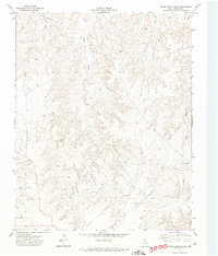
The Atchison Topeka and Santa Fe railroad cuts across this Roberts County landscape, anchoring the transit corridor through the Texas Panhandle. In 1972, this terrain was defined by a complex network of resource extraction, centered on an extensive Oil and Gas Field marked by numerous wells and a crisscrossing system of pipelines. Small clusters of activity appear at Clark and Edge, while the topographical shift of the Bluff provides a dramatic contrast to the flatter plains where Pumping Sta Water Tanks support the industrial infrastructure. Waterways like Bluff Creek and Red Deer Creek carve through the earth, revealing the underlying geology tapped by a Gravel Pit near the southern tracks. This survey documents the intersection of rail transport and energy production in the era of Texas oil expansion.
Find a feature on this map
14 named features on this map. Tap any name to fly to it.
Don’t see what you’re looking for? This feature index may not catch every label — zoom into the map to look around manually.
Map Details
Editions of this 1972 Pampa NE Map
This is the sole edition of this map. No revisions or reprints were ever made.
Other maps of this area

1954 · Amarillo
USGS Topo · 1:250,000

1958 · Amarillo
USGS Topo · 1:250,000

1963 · Pampa
USGS Topo · 1:24,000

1966 · Laketon
USGS Topo · 1:24,000

1967 · Hoover
USGS Topo · 1:24,000

1971 · Dry Creek South
USGS Topo · 1:24,000

1971 · Dry Creek SE
USGS Topo · 1:24,000

1971 · Pampa NW
USGS Topo · 1:24,000

1972 · Miami
USGS Topo · 1:24,000
1972 · Horse Creek South
USGS Topo · 1:24,000