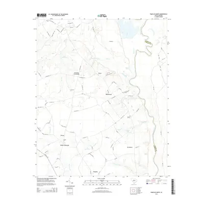
2014 Map of Pamplico North
USGS Topo · Published 2014About this map
The Great Pee Dee River meanders along the eastern edge of this landscape, defining the boundary between Marion and Florence Counties. This region is characterized by a network of rural hamlets and named intersections, including Pamplico, Gibbs Crossroads, and Kennedy Crossroads, which serve as the primary hubs for the surrounding agricultural tracts. The geography is heavily influenced by slow-moving water bodies and lowlands, most notably the area known as The Neck and various drainage systems such as Jeffries Cr and Big Swamp Br. Small family and community landmarks are scattered throughout the territory, providing essential points of reference for genealogists. Notable examples include Gibbs Cem, Pleasant Hill Cem, and Claussen Cem. These sites, alongside larger water features like H S Hyman Pond and Bowling Pond, illustrate the localized social and environmental structure of this South Carolina coastal plain community.
Find a feature on this map
87 named features on this map. Tap any name to fly to it.
Don’t see what you’re looking for? This feature index may not catch every label — zoom into the map to look around manually.
Map Details
Editions of this 2014 Pamplico North Map
This is the sole edition of this map. No revisions or reprints were ever made.
Other maps of this area

1940 · Florence East
USGS Topo · 1:62,500

1945 · Florence East
USGS Topo · 1:62,500

1946 · Hyman
USGS Topo · 1:62,500

1946 · Johnsonville
USGS Topo · 1:62,500

1947 · Friendship
USGS Topo · 1:24,000

1947 · Marion
USGS Topo · 1:24,000

1949 · Georgetown
USGS Topo · 1:250,000

1953 · Florence
USGS Topo · 1:250,000

1954 · Florence
USGS Topo · 1:250,000

1967 · Georgetown
USGS Topo · 1:250,000