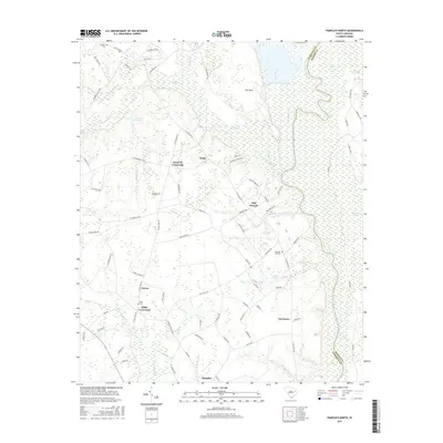
2017 Map of Pamplico North
USGS Topo · Published 2017About this map
The Great Pee Dee River defines the eastern boundary of this South Carolina landscape, separating Florence and Marion Counties. The interior is characterized by a network of rural settlements and crossroads including Kennedy Crossroads, Gibbs Crossroads, and the northern outskirts of Pamplico. The terrain is shaped by extensive drainage systems such as Jeffries Cr and Willow Cr, which feed into the river's wider basin near The Neck.
Find a feature on this map
91 named features on this map. Tap any name to fly to it.
Don’t see what you’re looking for? This feature index may not catch every label — zoom into the map to look around manually.
Map Details
Editions of this 2017 Pamplico North Map
This is the sole edition of this map. No revisions or reprints were ever made.
Other maps of this area

1940 · Florence East
USGS Topo · 1:62,500

1945 · Florence East
USGS Topo · 1:62,500

1946 · Hyman
USGS Topo · 1:62,500

1946 · Johnsonville
USGS Topo · 1:62,500

1947 · Friendship
USGS Topo · 1:24,000

1947 · Marion
USGS Topo · 1:24,000

1949 · Georgetown
USGS Topo · 1:250,000

1953 · Florence
USGS Topo · 1:250,000

1954 · Florence
USGS Topo · 1:250,000

1967 · Georgetown
USGS Topo · 1:250,000