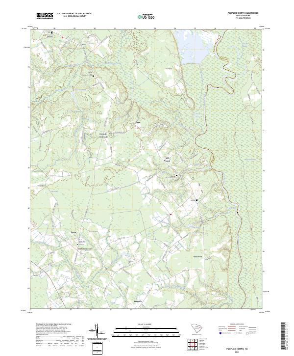
2024 Map of Pamplico North
USGS Topo · Published 2024About this map
Great Pee Dee River winding along the eastern boundary of Florence County defines this low-country landscape of coastal plains and dense wetlands. The river’s shifting course created distinctive features like Yellow Lake and the vast Pitch Pot Swamp, providing a natural buffer between the neighboring Marion County line. Settlement patterns follow the higher ground between watercourses, anchored by community hubs such as Pamplico and Gibbs Crossroads.
Find a feature on this map
99 named features on this map. Tap any name to fly to it.
Don’t see what you’re looking for? This feature index may not catch every label — zoom into the map to look around manually.
Map Details
Editions of this 2024 Pamplico North Map
This is the sole edition of this map. No revisions or reprints were ever made.
Other maps of this area

1940 · Florence East
USGS Topo · 1:62,500

1945 · Florence East
USGS Topo · 1:62,500

1946 · Hyman
USGS Topo · 1:62,500

1946 · Johnsonville
USGS Topo · 1:62,500

1947 · Friendship
USGS Topo · 1:24,000

1947 · Marion
USGS Topo · 1:24,000

1949 · Georgetown
USGS Topo · 1:250,000

1953 · Florence
USGS Topo · 1:250,000

1954 · Florence
USGS Topo · 1:250,000

1967 · Georgetown
USGS Topo · 1:250,000