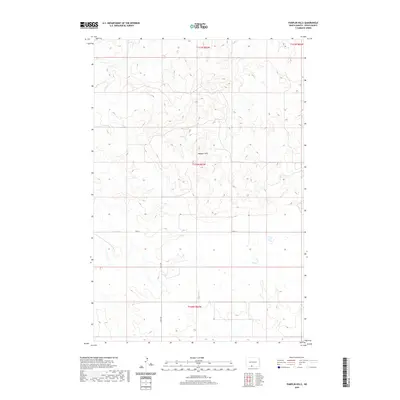
2020 Map of Pamplin Hills
USGS Topo · Published 2020About this map
Pamplin Hills rises as a prominent landmark in this section of Sioux County, located within the Porcupine District. The terrain is defined by the winding course of Oak Cr as it traverses the southeastern portion of the map, carving through the prairie landscape. Settlement patterns here are sparse, reflecting the open ranching and agricultural character of the North Dakota plains. A simple grid of section lines and rural roads, including 95th St and 34th Ave, provides the primary framework for navigation across the hills. This survey records the land before further modern development, focusing on the fundamental relationship between the drainage of the creek and the elevation of the surrounding heights.
Find a feature on this map
8 named features on this map. Tap any name to fly to it.
Don’t see what you’re looking for? This feature index may not catch every label — zoom into the map to look around manually.
Map Details
Editions of this 2020 Pamplin Hills Map
This is the sole edition of this map. No revisions or reprints were ever made.
Other maps of this area

1953 · McIntosh
USGS Topo · 1:250,000

1954 · Bismarck
USGS Topo · 1:250,000

1958 · Bismarck
USGS Topo · 1:250,000

1958 · McIntosh
USGS Topo · 1:250,000

1971 · Shields SW
USGS Topo · 1:24,000

1971 · Froelich Dam
USGS Topo · 1:24,000

1971 · Shields
USGS Topo · 1:24,000

1971 · Porcupine
USGS Topo · 1:24,000

1971 · Selfridge
USGS Topo · 1:24,000

1971 · Pamplin Hills
USGS Topo · 1:24,000