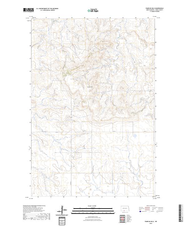
2024 Map of Pamplin Hills
USGS Topo · Published 2024About this map
Pamplin Hills dominates this section of Sioux County, where the high-altitude prairie landscape is defined by its complex drainage patterns and natural elevation changes. The land is sparsely marked by modern infrastructure, primarily the grid-based intersection of 95th St and 34th Ave, reflecting the expansive agricultural and ranching parcels of southern North Dakota. To the southeast, the terrain gives way to the course of Oak Creek, which serves as the primary hydrological feature in an otherwise arid expanse of upland ridges. This modern survey illustrates the persistent rural character of the region, showing how the Public Land Survey System continues to dictate the orientation of roads and property boundaries across the undulating hills of the Great Plains.
Find a feature on this map
8 named features on this map. Tap any name to fly to it.
Don’t see what you’re looking for? This feature index may not catch every label — zoom into the map to look around manually.
Map Details
Editions of this 2024 Pamplin Hills Map
This is the sole edition of this map. No revisions or reprints were ever made.
Other maps of this area

1953 · McIntosh
USGS Topo · 1:250,000

1954 · Bismarck
USGS Topo · 1:250,000

1958 · Bismarck
USGS Topo · 1:250,000

1958 · McIntosh
USGS Topo · 1:250,000

1971 · Shields SW
USGS Topo · 1:24,000

1971 · Froelich Dam
USGS Topo · 1:24,000

1971 · Shields
USGS Topo · 1:24,000

1971 · Porcupine
USGS Topo · 1:24,000

1971 · Selfridge
USGS Topo · 1:24,000

1971 · Pamplin Hills
USGS Topo · 1:24,000