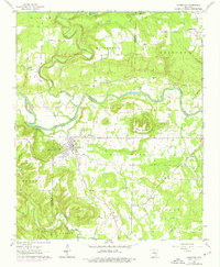
1962 Map of Pangburn
USGS Topo · Published 1976About this map
Pangburn serves as the central hub of this mid-century survey, situated where the terrain transitions from the elevations of Bruce Mountain and Marsh Mountain Creek toward the winding course of the Little Red River. The map documents a rural landscape defined by small settlements and family burial grounds, including Hickory Flat, McJester, and Barnett Cem. An Old Railroad Grade cutting through the western section provides a clear trace of former transport infrastructure that once connected these White County communities. Cultural landmarks such as the Full Gospel Ch and Pine View Ch are scattered throughout the township divisions, while industrial activity is noted at several Gravel Pits and a Shale Pit. The inclusion of a Flowing Well and various creek systems like Big Creek underscores the importance of local water resources in this agricultural and timber region.
Find a feature on this map
37 named features on this map. Tap any name to fly to it.
Don’t see what you’re looking for? This feature index may not catch every label — zoom into the map to look around manually.
Map Details
Editions of this 1962 Pangburn Map
3 editions found
Other maps of this area

1890 · Batesville
USGS Topo · 1:125,000

1891 · Batesville
USGS Topo · 1:125,000

1935 · Bald Knob
USGS Topo · 1:62,500

1953 · Memphis
USGS Topo · 1:250,000

1956 · Memphis
USGS Topo · 1:250,000

1962 · Pangburn
USGS Topo · 1:24,000

1962 · Letona
USGS Topo · 1:24,000

1963 · West Pangburn
USGS Topo · 1:24,000

1963 · Sidon
USGS Topo · 1:24,000

1965 · Pleasant Plains
USGS Topo · 1:24,000