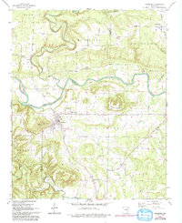
1962 Map of Pangburn
USGS Topo · Published 1993About this map
The town of Pangburn sits at the heart of this landscape where the Little Red River cuts through the border of Cleburne and White Counties. This 1962 survey, updated with photo-revisions in the 1970s and 1990s, documents a community defined by its topography and historical infrastructure. An Old Railroad Grade remains visible southwest of town, tracing a path near the Water Tank and the foothills of Mount Zion.
Find a feature on this map
38 named features on this map. Tap any name to fly to it.
Don’t see what you’re looking for? This feature index may not catch every label — zoom into the map to look around manually.
Map Details
Editions of this 1962 Pangburn Map
3 editions found
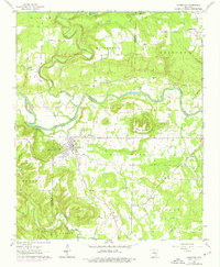
Other maps of this area

1890 · Batesville
USGS Topo · 1:125,000

1891 · Batesville
USGS Topo · 1:125,000

1935 · Bald Knob
USGS Topo · 1:62,500

1953 · Memphis
USGS Topo · 1:250,000

1956 · Memphis
USGS Topo · 1:250,000

1962 · Pangburn
USGS Topo · 1:24,000

1962 · Letona
USGS Topo · 1:24,000

1963 · West Pangburn
USGS Topo · 1:24,000

1963 · Sidon
USGS Topo · 1:24,000

1965 · Pleasant Plains
USGS Topo · 1:24,000