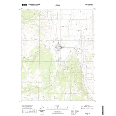
2020 Map of Panguitch
USGS Topo · Published 2020About this map
Panguitch serves as the central hub of this Garfield County landscape, where the confluence of Panguitch Cr and the Sevier River supports a complex network of agricultural irrigation. The map details an intricate system of water management, including the E Panguitch Canal, Long Canal, and E Bench Canal, which have historically sustained the valley's ranching and farming operations. Local history is anchored at the Garfield County Court House and the Panguitch City Cem, while the surrounding terrain is defined by dramatic local nomenclature such as Roller Mill Hill, Dickinson Hill, and Graveyard Hollow. The transition from the structured town grid to the varied topography of Fivemile Hollow and South Canyon illustrates the geographical constraints that shaped the development of this high-altitude settlement.
Find a feature on this map
88 named features on this map. Tap any name to fly to it.
Don’t see what you’re looking for? This feature index may not catch every label — zoom into the map to look around manually.
Map Details
Editions of this 2020 Panguitch Map
This is the sole edition of this map. No revisions or reprints were ever made.
Other maps of this area

1886 · Kanab
USGS Topo · 1:250,000

1953 · Cedar City
USGS Topo · 1:250,000

1958 · Cedar City
USGS Topo · 1:250,000

1958 · Panguitch Lake
USGS Topo · 1:62,500

1962 · Cedar City
USGS Topo · 1:250,000

1966 · Wilson Peak
USGS Topo · 1:24,000

1966 · Hatch
USGS Topo · 1:24,000

1966 · Panguitch NW
USGS Topo · 1:24,000

1971 · Fivemile Ridge
USGS Topo · 1:24,000
1971 · Panguitch
USGS Topo · 1:24,000