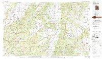
1980 Map of Panguitch
USGS Topo · Published 1981About this map
Hurricane Cliffs and the sprawling heights of the Dixie National Forest dominate this 1980 survey of the high plateau country. The map captures a landscape defined by dramatic geological transitions, from the Parowan Valley floor up to the Markagunt Plateau and the iconic Cedar Breaks National Monument. The Sevier River snakes through the central corridor, supporting settlements like Panguitch and Hatch along its course.
Find a feature on this map
41 named features on this map. Tap any name to fly to it.
Don’t see what you’re looking for? This feature index may not catch every label — zoom into the map to look around manually.
Map Details
Editions of this 1980 Panguitch Map
2 editions found

Other maps of this area

1885 · St. George
USGS Topo · 1:250,000

1885 · Beaver
USGS Topo · 1:250,000

1885 · Fish Lake
USGS Topo · 1:250,000

1886 · Kanab
USGS Topo · 1:250,000

1886 · Escalante
USGS Topo · 1:250,000

1891 · St. George
USGS Topo · 1:250,000

1896 · Fish Lake
USGS Topo · 1:250,000

1950 · Enoch
USGS Topo · 1:24,000

1950 · Cedar City
USGS Topo · 1:24,000

1950 · Enoch
USGS Topo · 1:62,500