
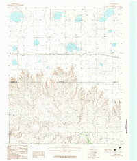
1966 Map of Panhandle East
USGS Topo · Published 1967About this map
Panhandle serves as a critical rail and agricultural hub on the Texas High Plains in this mid-1960s survey. The town's industrial footprint is anchored by the Atchison Topeka and Santa Fe railroad, which parallels a massive Grain Elevator and a central Radio Tower, reflecting the era's reliance on both rail transport and emerging telecommunications. Outside the main settlement, the landscape is defined by the winding course of McClellan Creek and numerous water management features, including a Sewage Disposal site and various wells scattered across the prairie.
Find a feature on this map
12 named features on this map. Tap any name to fly to it.
Don’t see what you’re looking for? This feature index may not catch every label — zoom into the map to look around manually.
Map Details
Editions of this 1966 Panhandle East Map
This is the sole edition of this map. No revisions or reprints were ever made.
Other maps of this area

1954 · Amarillo
USGS Topo · 1:250,000

1958 · Amarillo
USGS Topo · 1:250,000

1960 · Claude
USGS Topo · 1:62,500

1960 · Groom
USGS Topo · 1:62,500

1965 · White Deer
USGS Topo · 1:24,000

1965 · Abell
USGS Topo · 1:24,000

1966 · Panhandle West
USGS Topo · 1:24,000

1966 · Cuyler
USGS Topo · 1:24,000

1966 · White Deer SW
USGS Topo · 1:24,000
1983 · Lark
USGS Topo · 1:24,000