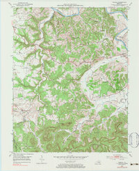
1952 Map of Panola
USGS Topo · Published 1984About this map
The Kentucky River cuts across the northern edge of this landscape, where the Louisville and Nashville River corridor connects the small rail-side communities of the early 1950s. The terrain is defined by the sharp divide between the Madison Co and Estill Co boundary, with the western portion dominated by the winding path of Drowning Creek. This survey captures a rural network of schoolhouses and family cemeteries that served the dispersed population, including Amerina Sch, Muddie Sch, and Sand Hill Sch.
Find a feature on this map
52 named features on this map. Tap any name to fly to it.
Don’t see what you’re looking for? This feature index may not catch every label — zoom into the map to look around manually.
Map Details
Editions of this 1952 Panola Map
3 editions found

Other maps of this area

1892 · Richmond
USGS Topo · 1:125,000

1892 · Beattyville
USGS Topo · 1:125,000

1897 · Richmond
USGS Topo · 1:125,000

1952 · Alcorn
USGS Topo · 1:24,000

1952 · Leighton
USGS Topo · 1:24,000

1952 · Union City
USGS Topo · 1:24,000

1952 · Palmer
USGS Topo · 1:24,000

1952 · Clay City
USGS Topo · 1:24,000

1952 · Irvine
USGS Topo · 1:24,000

1952 · Bighill
USGS Topo · 1:24,000