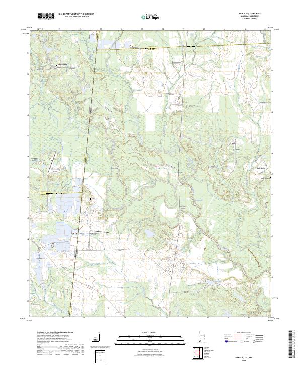
2024 Map of Panola
USGS Topo · Published 2024About this map
The Noxubee River meanders across the border of Alabama and Mississippi, defining a landscape where river crossings like Noxubee Ferry and Wall Ferry once served as vital links between the rural communities of Cooksville and Panola. The terrain is marked by numerous watercourses, including Woodward Creek and Beaver Creek, which flow through the marshy lowlands surrounding Noxubee Island.
Find a feature on this map
58 named features on this map. Tap any name to fly to it.
Don’t see what you’re looking for? This feature index may not catch every label — zoom into the map to look around manually.
Map Details
Editions of this 2024 Panola Map
This is the sole edition of this map. No revisions or reprints were ever made.
Other maps of this area

1953 · Meridian
USGS Topo · 1:250,000

1953 · West Point
USGS Topo · 1:250,000

1957 · Meridian
USGS Topo · 1:250,000

1958 · West Point
USGS Topo · 1:250,000

1963 · West Point
USGS Topo · 1:250,000

1965 · Meridian
USGS Topo · 1:250,000

1970 · Gainesville
USGS Topo · 1:24,000

1970 · Aliceville South
USGS Topo · 1:24,000

1970 · Warsaw
USGS Topo · 1:24,000

1973 · Panola
USGS Topo · 1:24,000