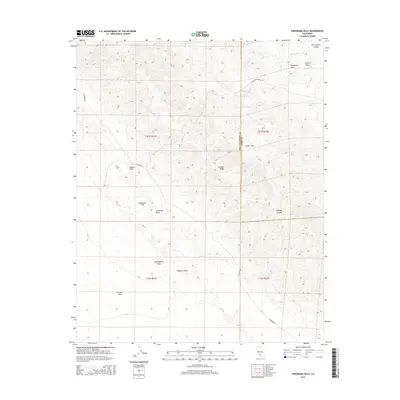
2015 Map of Panorama Hills
USGS Topo · Published 2015About this map
The San Andreas Fault bisects this portion of the California landscape, creating the prominent Elkhorn Scarp that separates the high-altitude Temblor Range from the broad Elkhorn Plain. This 2015 survey reveals a terrain defined by sharp tectonic activity and arid basins, where the San Luis Obispo and Kern County line runs north-to-south through the Crocker Flat and Panorama Hills.
Find a feature on this map
21 named features on this map. Tap any name to fly to it.
Don’t see what you’re looking for? This feature index may not catch every label — zoom into the map to look around manually.
Map Details
Editions of this 2015 Panorama Hills Map
This is the sole edition of this map. No revisions or reprints were ever made.
Other maps of this area

1912 · McKittrick
USGS Topo · 1:125,000

1932 · West Elk Hills
USGS Topo · 1:31,680

1941 · Caliente Mountain
USGS Topo · 1:62,500

1942 · Caliente Mtn
USGS Topo · 1:62,500

1943 · Simmler
USGS Topo · 1:62,500

1943 · Caliente Mtn.
USGS Topo · 1:62,500

1944 · Panorama Hills
USGS Topo · 1:31,680
1944 · Fellows
USGS Topo · 1:31,680
1944 · Elkhorn Hills
USGS Topo · 1:31,680
1944 · Midway Peak SW
USGS Topo · 1:31,680