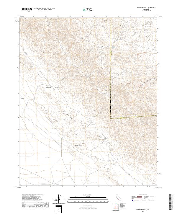
2021 Map of Panorama Hills
USGS Topo · Published 2021About this map
The Temblor Range defines the high ground along the border of San Luis Obispo and Kern Counties, forming a dramatic boundary between the Carrizo Plain and the San Joaquin Valley. This arid landscape is shaped by the tectonic forces of the San Andreas Fault, which is evidenced by the distinct Elkhorn Scarp that cuts through the Elkhorn Plain. Historically, this area has remained largely undeveloped, characterized by wide-open rangelands and seasonal water sources like Crocker Spring in the northern canyons.
Find a feature on this map
25 named features on this map. Tap any name to fly to it.
Don’t see what you’re looking for? This feature index may not catch every label — zoom into the map to look around manually.
Map Details
Editions of this 2021 Panorama Hills Map
This is the sole edition of this map. No revisions or reprints were ever made.
Other maps of this area

1912 · McKittrick
USGS Topo · 1:125,000

1932 · West Elk Hills
USGS Topo · 1:31,680

1941 · Caliente Mountain
USGS Topo · 1:62,500

1942 · Caliente Mtn
USGS Topo · 1:62,500

1943 · Simmler
USGS Topo · 1:62,500

1943 · Caliente Mtn.
USGS Topo · 1:62,500

1944 · Panorama Hills
USGS Topo · 1:31,680
1944 · Fellows
USGS Topo · 1:31,680
1944 · Elkhorn Hills
USGS Topo · 1:31,680
1944 · Midway Peak SW
USGS Topo · 1:31,680