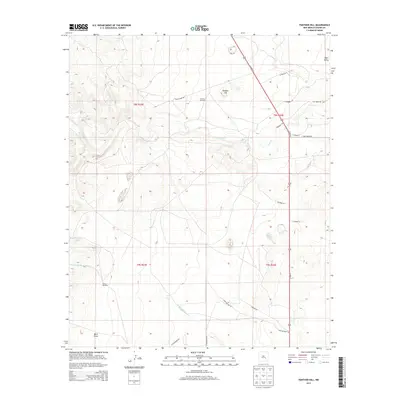
2013 Map of Panther Hill
USGS Topo · Published 2013About this map
Panther Hill rises as a central landmark in this portion of Chaves County, characterized by a sparse network of ranch roads and water infrastructure. The landscape is defined by the seasonal flow of Salt Cr and Middle Berrendo Cr, punctuated by vital water sources such as the Panther Windmill, Butler Windmill, and Tom Ned Tank. These features suggest a working rangeland environment where the distribution of water dictated the movement of livestock and the placement of human activity.
Find a feature on this map
26 named features on this map. Tap any name to fly to it.
Don’t see what you’re looking for? This feature index may not catch every label — zoom into the map to look around manually.
Map Details
Editions of this 2013 Panther Hill Map
This is the sole edition of this map. No revisions or reprints were ever made.
Other maps of this area

1949 · Roswell North
USGS Topo · 1:24,000

1949 · Corn Ranch
USGS Topo · 1:24,000

1950 · Corn Ranch
USGS Topo · 1:24,000

1950 · Bitter Lake
USGS Topo · 1:24,000

1955 · Roswell
USGS Topo · 1:250,000

1958 · Roswell
USGS Topo · 1:250,000

1962 · Roswell
USGS Topo · 1:250,000
1962 · Roswell North
USGS Topo · 1:24,000

1962 · Rock House Canyon
USGS Topo · 1:24,000
1962 · Bitter Lake
USGS Topo · 1:24,000