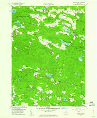
1959 Map of Panther Lake
USGS Topo · Published 1960About this map
State Reforestation Area dominates the northern reaches of this Oswego County landscape, which transitions from high timberland down toward the shoreline of Oneida Lake. The area is characterized by a dense network of small hamlets and family-named crossroads, including Amboy Center, Dutcherville, and Halls Corners. In the central portion of the sheet, Panther Lake serves as a local focal point, surrounded by access roads like North Shore Dr and Birmingham Drive.
Find a feature on this map
60 named features on this map. Tap any name to fly to it.
Don’t see what you’re looking for? This feature index may not catch every label — zoom into the map to look around manually.
Map Details
Editions of this 1959 Panther Lake Map
3 editions found
Other maps of this area

1895 · Chittenango
USGS Topo · 1:62,500

1895 · Syracuse
USGS Topo · 1:62,500

1898 · Syracuse
USGS Topo · 1:62,500

1898 · Chittenango
USGS Topo · 1:62,500

1902 · Chittenango
USGS Topo · 1:62,500

1905 · Mexico
USGS Topo · 1:62,500

1906 · Kasoag
USGS Topo · 1:62,500

1940 · Cicero
USGS Topo · 1:24,000

1941 · Cleveland
USGS Topo · 1:24,000

1941 · Jewell
USGS Topo · 1:24,000