
1952 Map of Parade NW
USGS Topo · Published 1954About this map
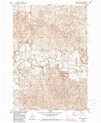
The Moreau River meanders deeply across this 1950s landscape, defining the topography of the Cheyenne River Indian Reservation. This map, produced as part of the Department of the Interior program for the development of the Missouri River Basin, shows the confluence of Green Grass Creek and the main river channel near the settlement of Green Grass. The terrain is characterized by intricate drainage patterns from Meadow Creek and Redwater Creek, reflecting the complex erosional history of the Dewey County plains.
Find a feature on this map
10 named features on this map. Tap any name to fly to it.
Don’t see what you’re looking for? This feature index may not catch every label — zoom into the map to look around manually.
Map Details
Editions of this 1952 Parade NW Map
2 editions found
Other maps of this area

1952 · Parade NE
USGS Topo · 1:24,000

1952 · Lantry NE
USGS Topo · 1:24,000

1953 · McIntosh
USGS Topo · 1:250,000

1958 · McIntosh
USGS Topo · 1:250,000

1978 · Peach Lake
USGS Topo · 1:24,000

1978 · Little Moreau Lake
USGS Topo · 1:24,000

1978 · Livermant Lake
USGS Topo · 1:24,000

1981 · Parade SW
USGS Topo · 1:24,000
1981 · Parade
USGS Topo · 1:24,000
1981 · Lantry SE
USGS Topo · 1:24,000