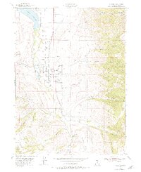
1955 Map of Paradise
USGS Topo · Published 1971About this map
The Little Bear River valley in the mid-1950s is defined by a landscape of high-altitude irrigation and agricultural persistence, anchored by the settlements of Paradise, Hyrum, and Avon. A complex network of water management features, including an Aqueduct, several Canal segments, and a Ditch system, illustrates the engineering required to sustain these communities on the edge of the Cache National Forest. The presence of a Trout Farm and the large Hyrum Reservoir highlights the intersection of natural river systems and local industry during this era.
Find a feature on this map
42 named features on this map. Tap any name to fly to it.
Don’t see what you’re looking for? This feature index may not catch every label — zoom into the map to look around manually.
Map Details
Editions of this 1955 Paradise Map
3 editions found
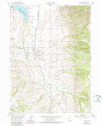
Other maps of this area

1914 · Logan
USGS Topo · 1:125,000

1916 · Logan
USGS Topo · 1:125,000

1954 · Ogden
USGS Topo · 1:250,000

1955 · Paradise
USGS Topo · 1:24,000

1955 · Mantua
USGS Topo · 1:24,000

1955 · James Peak
USGS Topo · 1:24,000

1955 · Mount Pisgah
USGS Topo · 1:24,000

1958 · Ogden
USGS Topo · 1:250,000

1960 · Ogden
USGS Topo · 1:250,000

1961 · Logan
USGS Topo · 1:24,000