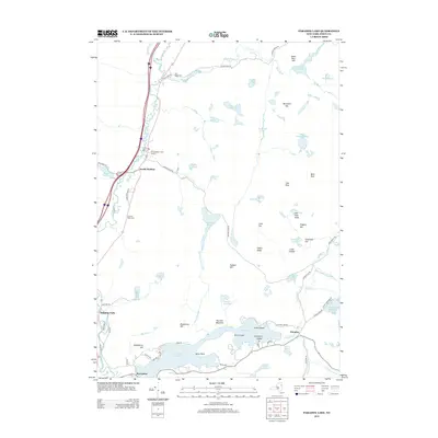
2013 Map of Paradox Lake
USGS Topo · Published 2013About this map
Paradox Lake dominates the southern landscape of this Adirondack region, flanked by the communities of Severance and Paradox. To the north, the Schroon River winds alongside the major highway corridor, passing through North Hudson and past Schroon River Cem. The terrain is defined by a dense network of high-elevation water bodies and named peaks, including Moose Mountain Pond, Johnson Pond, and Bald Pate.
Find a feature on this map
77 named features on this map. Tap any name to fly to it.
Don’t see what you’re looking for? This feature index may not catch every label — zoom into the map to look around manually.
Map Details
Editions of this 2013 Paradox Lake Map
This is the sole edition of this map. No revisions or reprints were ever made.
Other maps of this area

1894 · Elizabethtown
USGS Topo · 1:62,500

1895 · Elizabethtown
USGS Topo · 1:62,500

1895 · Mt. Marcy
USGS Topo · 1:62,500

1895 · Paradox Lake
USGS Topo · 1:62,500

1897 · Paradox Lake
USGS Topo · 1:62,500

1897 · Schroon Lake
USGS Topo · 1:62,500

1901 · Elizabethtown
USGS Topo · 1:62,500

1902 · Mt. Marcy
USGS Topo · 1:62,500

1950 · Glens Falls
USGS Topo · 1:250,000

1950 · Lake Champlain
USGS Topo · 1:250,000