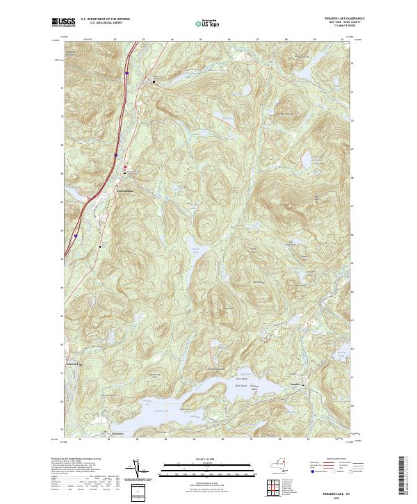
2023 Map of Paradox Lake
USGS Topo · Published 2023About this map
North Hudson and the settlement of Paradox anchor this map of the eastern Adirondack foothills, where the Schroon River flows southward through a landscape defined by glacial ponds and rocky heights. The survey reveals a network of historical burial grounds, including the Pine Ridge Cem, Schroon River Cem, and the Holy Name of Jesus and Mary Cem, which serve as vital markers for genealogical research in this part of Essex County. The geography is characterized by numerous small bodies of water like Berrymill Pond and Johnson Pond, connected by an intricate system of trails such as the Hammond Pond Trl and Bass Lake Trl. Significant terrain features like Narrows Mountain and Blue Hill overlook Paradox Lake, while the local history of small communities is preserved in labels like Little Canada and Schroon Falls.
Find a feature on this map
84 named features on this map. Tap any name to fly to it.
Don’t see what you’re looking for? This feature index may not catch every label — zoom into the map to look around manually.
Map Details
Editions of this 2023 Paradox Lake Map
This is the sole edition of this map. No revisions or reprints were ever made.
Other maps of this area

1894 · Elizabethtown
USGS Topo · 1:62,500

1895 · Elizabethtown
USGS Topo · 1:62,500

1895 · Mt. Marcy
USGS Topo · 1:62,500

1895 · Paradox Lake
USGS Topo · 1:62,500

1897 · Paradox Lake
USGS Topo · 1:62,500

1897 · Schroon Lake
USGS Topo · 1:62,500

1901 · Elizabethtown
USGS Topo · 1:62,500

1902 · Mt. Marcy
USGS Topo · 1:62,500

1950 · Glens Falls
USGS Topo · 1:250,000

1950 · Lake Champlain
USGS Topo · 1:250,000